Yaas alert: Landfall completed, Severe cyclone weakens later
Yaas cyclone is expected to move north-northwest and weaken gradually.

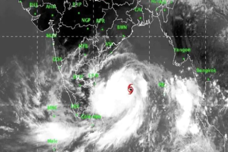
The National Meteorological Center of India Meteorological Department (IMD) said that 'YAS' has become centered near latitude 21.45 and longitude 86.8 OE in northern coastal Odisha at 12.30 pm on Wednesday. It is passing through Dhamra and Balasore in Odisha, about 15 km west-south of Balasore. Now it has turned into a severe cyclone.
During the next six hours, it is expected to move north-northwest and weaken gradually by turning into a cyclonic storm. The cyclone started the landfall process around 9 am.
Uma Shankar Das, senior scientist at the Meteorological Center, Bhubaneswar, said, "Cyclone Yas has completed the process of touching the earth. The rain in the affected areas will continue till tomorrow. Fishermen are advised not to venture till tomorrow morning , Because the sea situation is going to deteriorate. "
According to IMD forecasts, the wind speed of the storm gradually decreased to 110 km per hour at a speed of 90–100 km per hour during the next three hours and 80 km per hour at a speed of 60–70 km per hour during the subsequent six hours.
According to IMD's report at 1.30 pm, the cyclone is currently near its center and is blowing winds at a speed of about 130-140 km per hour at a speed of 155 km per hour. The cyclone moved north-northwest at a speed of about 13 km per hour during the last six hours.
IMD said tidal waves of 1-2 meters above the astronomical tides are likely to submerge in the low lying areas of Balasore, Bhadrak, Medinipur and South 24 Parganas districts during the next 2-3 hours and then gradually subside.
This cyclone is bringing light to moderate rainfall in most places with heavy to very heavy rainfall and very heavy rainfall at isolated places in Jharkhand on Wednesday and Thursday.
Source- Agency